Bar-K Site
Locals
Quick Topics
Fun
Links
Tools
Weather
|
|
Bar-K Site |
||||||||||
|
Locals |
|
||||||||||
|
Quick Topics |
|
|
|||||||||
|
Fun |
|||||||||||
|
Links |
|
|
|||||||||
|
Tools |
|||||||||||
|
Weather |
Welcome To Bar-K Ranch ..... a small mountain community at approximately 8600 ft in the Rocky Mountains of Colorado. Read More
![]()
Discuss Bar-K Ranch QT
Bar-K Ranch Colorado
James Creek Fuel Reduction Project Update
Related
Documents Here
The James Creek Fuel Reduction Project which included extensive public contact including 4 public meetings and several extensive informational mailings resulted in a decision made on February 15, 2005. The decision enabled the Forest Service to treat up to 6,204 acres of National Forest System (NFS) lands within the analysis area. The decision includes a mixture of treatments such as manual and mechanical thinning and patch clearcutting, aspen enhancement, prescribed fire (broadcast burning and pile burning), and road management activities. The Environmental Assessment summarized the findings of a no action and three action alternatives that were developed based on key issues generated from public meetings and comment letters. Those key issues focused on the scenery effects from clearcutting, the risk of escaped fire, road construction, and increased public access from created openings. The environmental assessment and decision document are can be found on the Forest Service website at: www.fs.usda.gov/arp. Click on “Land and Resource Management,” then “projects,” look for James Creek Fuel Reduction Project.
Treatment areas were designed to reduce the potential for crown fire initiation and spread by thinning forest stands, creating gaps in the continuous canopy, and removing ladder fuel that would allow ground fire to reach the tops of trees. Treatments were also designed to connect with each other, with natural openings, with existing aspen stands that could serve as fuel breaks, and with past treatments to create a mosaic effect and to keep costs at a minimum. They also connect with the Overland Fire burn area. Slope steepness and access helped us determine whether we will use manual crews or mechanical equipment to treat the planned units.
Many of you told us you noticed some of the fuel mitigation work on the ridges and slopes just west of Jamestown. Those areas were treated by crews using chainsaws and piled by hand because of steep slopes and limited access. The prescription for that area focused on cutting smaller diameter trees that could be moved by hand. On the flatter ground, we are using mechanical equipment that may include skidders, whole tree harvesters, feller-bunchers, grinders, and mastication equipment. Using this equipment allows us to cut and remove trees of all sizes from a stand. This is important in achieving the fuel reduction objectives. It allows us to thin the canopy, create gaps between groups of trees, and remove the ladder fuels. The end result is a stand that has a more diverse physical structure and species composition, resulting in a healthier stand that is more resilient and resistant to insects, diseases and fire. Mountain pine beetles tend to favor infesting the larger, mature trees. A ponderosa pine or mixed conifer stand with well spaced, trees of varied sizes will have a better chance of surviving the current beetle outbreak.
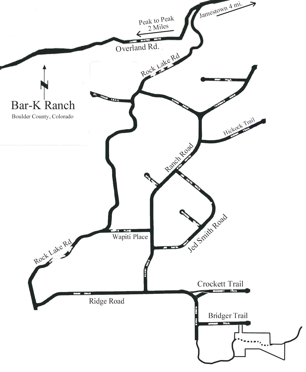
There are several other stands nearby that will be treated with mechanical equipment in the near future. The treatment units have been marked on the ground. They are located on NFS lands along County Road 94 at the entrance to the Bar-K subdivision and south of Rock Lake. Treatments in these stands will be similar to the thinning treatment near the Overland Mountain subdivision. Some areas will include several patch clearcuts up to 5 acres in size each.
There are many areas on the Boulder Ranger District, as well as on Boulder County Open Space properties that have been treated for fuel reduction using mechanical equipment over the past eight years. Please go visit these areas to see how they look today. The prescriptions are very similar to the treatment area at Overland. We have some very recent treatments along the Gold Lake Road that treated the stand for fuel reduction, leaving a variety of tree sizes and species. These stands will all show evidence of forest management such as skid road and landing locations. Over time, all of these treated stands will be healthier.
Areas to Visit
· Along Magnolia Road (Road 132)
· Along the Gold Hill Road (Road 52)
· Along the Gold Lake Road (Road 102) recently treated
· On Boulder County Open Space property in Sunshine Canyon
· Related Documents Here
(Older MS Word program users may need to download Microsoft Office Compatibility Pack for Word, Excel, and PowerPoint File Formats to view docx files) Here


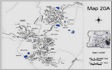
| Click Map To View Full Size Version | ||
 |
 |
|
| Download this PDF Map Here Download this PDF Map Here | ||
|
(Requires Adobe®
Reader) |
||